 Zambia NSDI
Zambia Land Cover 2023
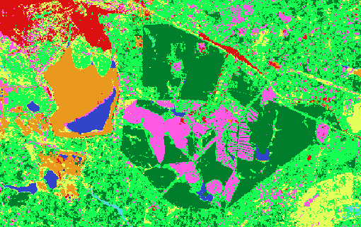
Raster land cover maps of Zambia for 2023 produced using modern geospatial methodologies, specifically focusing on Copernicus Sentinel-2 satellite data. The selected land cover legend with 8 classes (forest, shrubland, grassland, cropland, built-up, bare land, water, and wetlands) is in line with other ongoing projects (e.g., EU funded” Sustainable Landscape through Integrated Management” (SLIM) project) and meets internationally accepted standards, allowing for cross-country comparisons. Various datasets were used as input data alongside the Sentinel-2 satellite data, such as Copernicus Digital Elevation Model, vegetation height information, built-up surface data from JRC, while training and validation data were collected using high-resolution imagery. Advanced machine learning algorithms were tested for land cover classification using multi-temporal approaches (considering the high variability in vegetation response due to seasonal changes) to enhance the classification results.
Simple
- Date (Publication)
- 2024-11-21T13:05:00+03:00
- Edition
-
Version 1
- Purpose
-
The NLA land-cover dataset was created to provide a consistent, nationwide representation of Zambia’s physical land surface. It supports the National Land Audit by enabling the assessment of land-cover distribution, environmental conditions and changes over time. The dataset is intended to support national and subnational planning, natural-resource management, environmental assessment, land monitoring, statistical reporting and publication through ZNSDI. It is not intended for determining cadastral boundaries, land ownership or site-specific engineering decisions.
- Status
- On going
- Point of contact
-
Organisation name Individual name Electronic mail address Role MLNR
Elly Mulenga
Custodian
- Maintenance and update frequency
- As needed
- Theme
-
-
Land cover; National Land Audit; NLA; Zambia; earth observation; remote sensing; Sentinel-2; land-cover classification
-
Land cover
-
- Access constraints
- Copyright
- Use constraints
- otherRestictions
- Spatial representation type
- Grid
- Language
-
eng
- Character set
- UTF8
- Topic category
-
- Imagery base maps earth cover
- Begin date
- 2023-02-08
- End date
- 2023-12-08
))
- Reference system identifier
- WGS 1984
- Number of dimensions
- 2
- Dimension name
- Row
- Dimension size
- 130316
- Resolution
- 10 m
- Dimension name
- Column
- Dimension size
- 110065
- Resolution
- 10 m
- Cell geometry
- Area
- Hierarchy level
- Dataset
- Statement
-
The produced national land cover maps for 2023 and 2017 achieved high overall accuracies (around 85%). The 2023 map showed that forest areas dominate the landscape (38.6%), followed by shrubland (34.8%), grassland (11.8%), and cropland (9.4%).
Metadata
- File identifier
- 9724a15d-eaa7-45b4-b24b-35601de0dab3 XML
- Metadata language
- English
- Character set
- UTF8
- Date stamp
- 2026-09-08T08:34:19.720962Z
- Metadata standard name
-
ISO 19115:2003/19139
- Metadata standard version
-
1.0
- Metadata author
-
Organisation name Individual name Electronic mail address Role MLNR
Elly Mulenga
Custodian
)))